
Keep the information after the paint fades
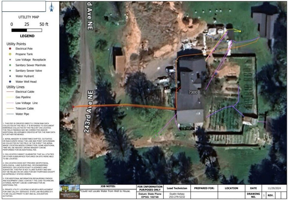
Field paint and flags solve an immediate problem. Utility mapping preserves the located information for planning, coordination, repairs and future work. GroundScout organizes field findings on an aerial image, site plan or GIS basemap based on the scope.
Mapping can follow a new private utility locate or organize existing field data supplied by the project team. Each deliverable identifies what was located, when it was captured and any limits that matter to future users.
Mapping deliverables
PDF utility map
A practical map for project folders, permit coordination, field crews and stakeholder review.
CAD or KML files
Digital linework for engineers, survey teams, contractors and location-based planning workflows.
GIS utility layers
Structured utility records for campuses, facilities, portfolios and long-term asset management.
From locate to usable record
Collect field data
Located alignments, visible features, notes, photos and GPS points are captured within the agreed scope.
Build the map
Utilities are organized by type and overlaid on the selected basemap, aerial or plan file.
Deliver the files
The final files are prepared for the people who will use them in the field, office or asset system.
Common uses
- Preconstruction and excavation planning
- Tenant improvements and site upgrades
- Leak repair and maintenance coordination
- Commercial property due diligence
- Campus and facility utility records
- Capital improvement and long-range planning
Accuracy and verification
Map accuracy depends on the field method, GPS method, available access and whether a utility was located, visually exposed or surveyed. GroundScout documents the methodology and relevant limitations. A utility map supports planning, but critical excavation should still follow current 811 requirements, field marks and appropriate verification practices.
Utility mapping FAQs
Is a utility map the same as a land survey?
No. GroundScout documents located utilities and related field information. It does not replace a boundary, topographic or engineering survey.
Can you use our site plan?
Yes. A supplied site plan, CAD file or aerial can be used when it fits the project and deliverable.
Which file format should we request?
PDF works well for most field teams. CAD, KML or GIS formats are better when the data must enter a design or asset-management workflow.