
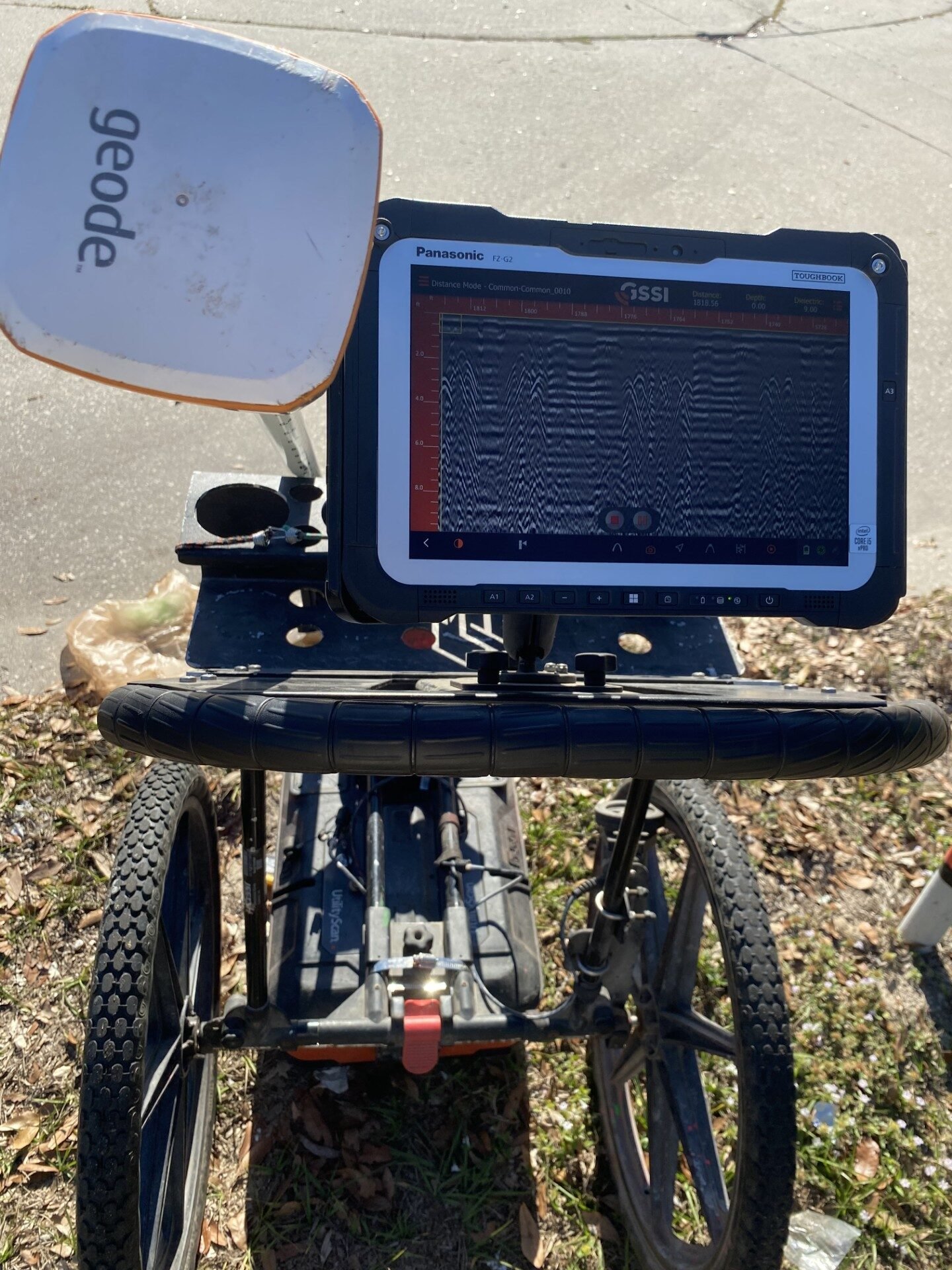
If you’ve ever stared at a set of “as-builts” that were definitely created during the Jurassic period, you already know the truth: modern utility locating isn’t one tool — it’s a toolkit. The best locates combine multiple technologies to reduce risk, prevent strikes, and keep crews moving.
1) Ground Penetrating Radar (GPR)
What it does: Sends radar pulses into the ground and reads reflections to help identify buried objects and anomalies — including metallic and non-metallic utilities.
Why it’s useful:
Finds utilities that EM can’t “energize” (like many non-metal pipes)
Helps confirm depth ranges and clustering (multiple lines in tight corridors)
Great for verifying “there’s something here” before you cut, bore, or trench
Best for: Paved utility corridors, unknown sites, pre-construction due diligence.
2) Electromagnetic (EM) Pipe & Cable Locators
What it does: Uses a transmitter + receiver to trace conductive utilities (power, telecom, metallic pipes, tracer wire).
Why it’s useful:
Fast line tracing and direction finding
Strong for long-distance runs
Ideal for “paint-and-flag” field marking when conditions are right
Best for: Power/telecom, metallic gas/water, anything with tracer wire.
3) EM Induction + Signal Accessories (Clamps, Direct Connect, Tracer Wire)
What it does: Improves EM performance by choosing the right way to apply signal: induction, clamp-on, or direct connection (and sometimes adding tracer wire solutions when appropriate).
Why it’s useful:
Cleaner signal = fewer “ghost” lines
Better tracing through congested sites
Higher confidence when stakes are high (boring and deep excavation)
Best for: Congested utility corridors, industrial sites, multi-line environments.
4) Sondes + Duct Rodders (for Non-Metal Pipes)
What it does: A sonde is a small transmitter you can push through a line (often via rodder/push camera) so it can be tracked from the surface.
Why it’s useful:
Locates non-metal pipe routes when EM tracing isn’t possible
Helps map laterals and bends
Great when access points exist but the line material isn’t traceable
Best for: Sewer laterals, storm lines, non-metal conduits, unknown non-metal utilities.
5) Push Cameras (Lateral Inspection + Route Confirmation)
What it does: A flexible camera line fed into smaller diameter pipes; often paired with a sonde to locate from the surface. Why it’s useful:
Confirms pipe condition and alignment
Helps identify taps, breaks, offsets, and blockages
Great for owners: “Here’s the video — here’s the location.”
Best for: Small lines, laterals, troubleshooting, pre-renovation verification.
6) Robotic CCTV Crawlers (Mainline Inspection)
What it does: Remote crawlers run through larger pipes for recorded inspection and precise route/context.
Why it’s useful:
High-detail documentation of pipe condition
Helps confirm alignment in large systems
Useful for municipal/industrial assets where repairs are expensive
Best for: Large sewer/storm systems, industrial piping, condition assessment.
7) Magnetometers (Ferrous Metal Detection)
What it does: Detects disturbances in magnetic fields caused by ferrous metal objects.
Why it’s useful:
Helps find buried valves, manholes, tanks, wellheads, and other ferrous assets
Quick “is there metal here?” screening tool
Helpful for pinpointing isolated metal targets
Best for: USTs, valves, caps, wellheads, ferrous features.
8) Acoustic Leak Detection (Listening for the Problem)
What it does: Uses microphones/sensors to detect the sound signatures of leaks in pressurized lines.
Why it’s useful:
Non-invasive leak pinpointing
Saves money vs. exploratory digging
Faster isolation = less downtime
Best for: Water loss investigations, pressurized water systems, facility maintenance.
9) Leak Correlators + Pressure/Signal Analysis
What it does: Correlates acoustic signals across sensors to identify the likely leak location (especially useful when leaks are subtle or conditions are noisy).
Why it’s useful:
Better accuracy over longer runs
Helps in difficult acoustic environments
Reduces “guess-and-dig” repairs
Best for: Larger sites, long mains, complex systems, recurring leaks.
10) Mapping, Modeling, and “Deliverables That Don’t Get Lost”
What it does: Turns field findings into useful outputs: georeferenced maps, CAD/GIS files, PDFs, site plans, and documented mark-outs that can be reused.
Why it’s useful:
Aligns trades, GCs, owners, and engineers on one source of truth
Helps plan future phases without re-locating everything
Supports budgeting: fewer surprises, fewer delays
Best for: Preconstruction planning, phased renovations, long-term facility ops.
No single technology wins 100% of the time. Soil conditions, depth, utility material, congestion, and access points all affect results. The most reliable approach is layering tools (typically GPR + EM + verification methods) and following a consistent process/training standard.
If you’re searching for a utility locator near me, planning excavation, or trying to figure out how to find utilities before digging, modern locating tools can make the difference between a clean project and a very expensive surprise. The right locator will choose the best combination of GPR, EM locating, camera inspection, and mapping to match your site conditions — and deliver clear markings and documentation you can trust.